
Aeronautical Chart Kaitaia (1975)

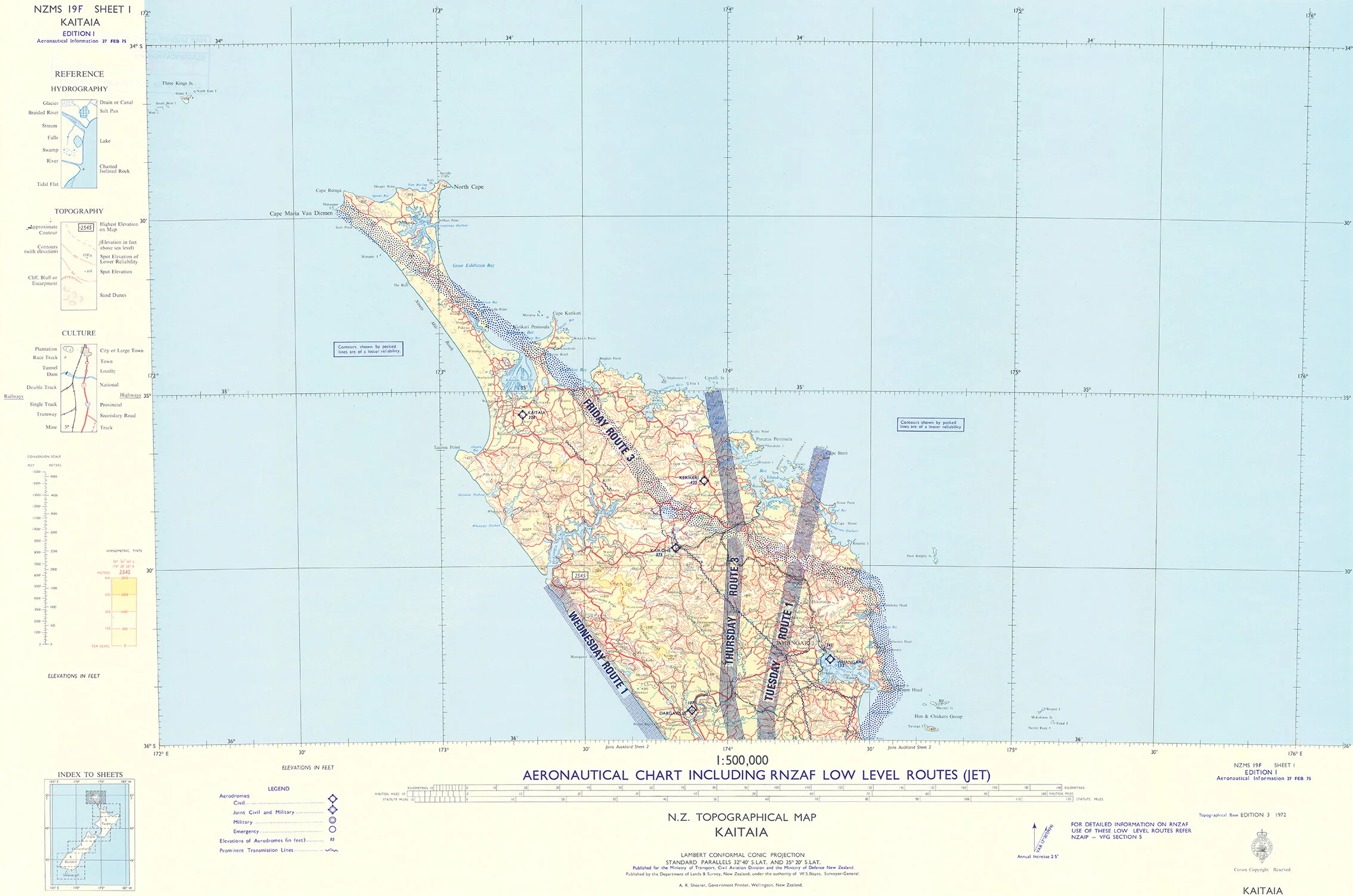


Aeronautical Chart Kaitaia (1975)
This vintage Kaitaia Aeronautical Chart from 1975, which includes RNZAF low-level flying routes, would delight lovers of aviation.
It looks fantastic in an office, where it’d make a wonderful talking point about which day the planes flew where. And it would make the perfect gift for your Northland friends.
This map comes in a 2 x 3 aspect and we offer two different finishing options. Please choose from the following selection to make it your own.
ㅤ
Acrylic Print
Perfect for any room where gallery quality is optimal, our Acrylic Prints are also ideal for bathrooms and wet areas.
Your map will be printed in our boutique print studio on Kodak Professional substrate using archival inks, and then mounted in-house on crystal clear acrylic for a back-lit appearance and unrivaled vibrancy.
Finally, it will be seamed with 4mm ACM (Aluminium Composite Material) for a modern frameless finish. A custom hanger is attached before the print is securely packaged and sent to you, ready to hang on your wall.
ㅤ
Wall Art on ACM
Our ACM Wall Art prints are sleek and non-reflective. Your photograph will be printed in our boutique print studio on Kodak Professional Paper using archival inks and then mounted in-house on 4mm ACM.
A custom hanger is attached before the print is securely packaged and sent to you, ready to hang on your wall.
ㅤ
Please note:
All maps come with their original patina and stamps, adding to their character.
Prints will be created, finished, packed and sent within 3 weeks of ordering but can often be finished much sooner.
All prints will be sent tracked through New Zealand Post until their size limit of 1.5 metres has been reached.
We crate our largest prints to ensure their safe arrival and use Post Haste or Kiwi Oversize for delivery.
We can absolutely ship overseas from New Zealand, please enquire about postage.


